Locations ·
The Rio de Janeiro Skyline From Above
Shooting Rio de Janeiro's skyline from above is what draws many photographers here in the first place — the arc of the beaches, the granite peaks, and the bay all in one frame. Getting that shot means picking the right high vantage point and knowing what is legal in the air, because Brazil's drone rules are strict and enforced. This guide covers the best elevated viewpoints, how drones are actually regulated, and helicopter tours as the legal aerial alternative.
What the Rio de Janeiro skyline actually is
Rio does not have a skyline in the way New York or São Paulo does. There is no single wall of towers to photograph, because the city was built around granite rather than over it — the monoliths of Sugarloaf, Corcovado, Pedra da Gávea and Dois Irmãos are the vertical elements, and the buildings fill the gaps between them. Understanding that is the difference between a flat, disappointing frame and one that reads as Rio at a glance.
In practice the Rio de Janeiro skyline comes in three distinct versions, and they are not interchangeable:
- The bay skyline — Sugarloaf, the crescent of Botafogo and the Centro towers stacked behind Guanabara Bay. This is the postcard, and the one most people mean by "the Rio skyline".
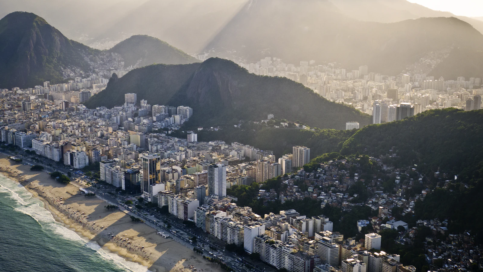
- The beach skyline — the wall of mid-century apartment blocks running behind Copacabana and Ipanema, with Dois Irmãos closing the frame at the far end.
- The mountain skyline — the granite peaks themselves as the horizon line, with the built city reduced to foreground. This is the version that only works from the Tijuca overlooks.
Decide which of the three you want before you pick a viewpoint, because no single vantage point gives you all of them. The sections below cover where each one is shot from.
Best high viewpoints for the skyline
You do not need to fly to get an aerial-looking frame; Rio's terrain does much of the work. The classic is the Mirante Dona Marta, a belvedere on the slopes below Corcovado that gives the postcard view — Sugarloaf, Botafogo and Flamengo curving around Guanabara Bay, with the whole Zona Sul laid out below. It is reachable by car or tour and is at its best in the soft light of early morning.
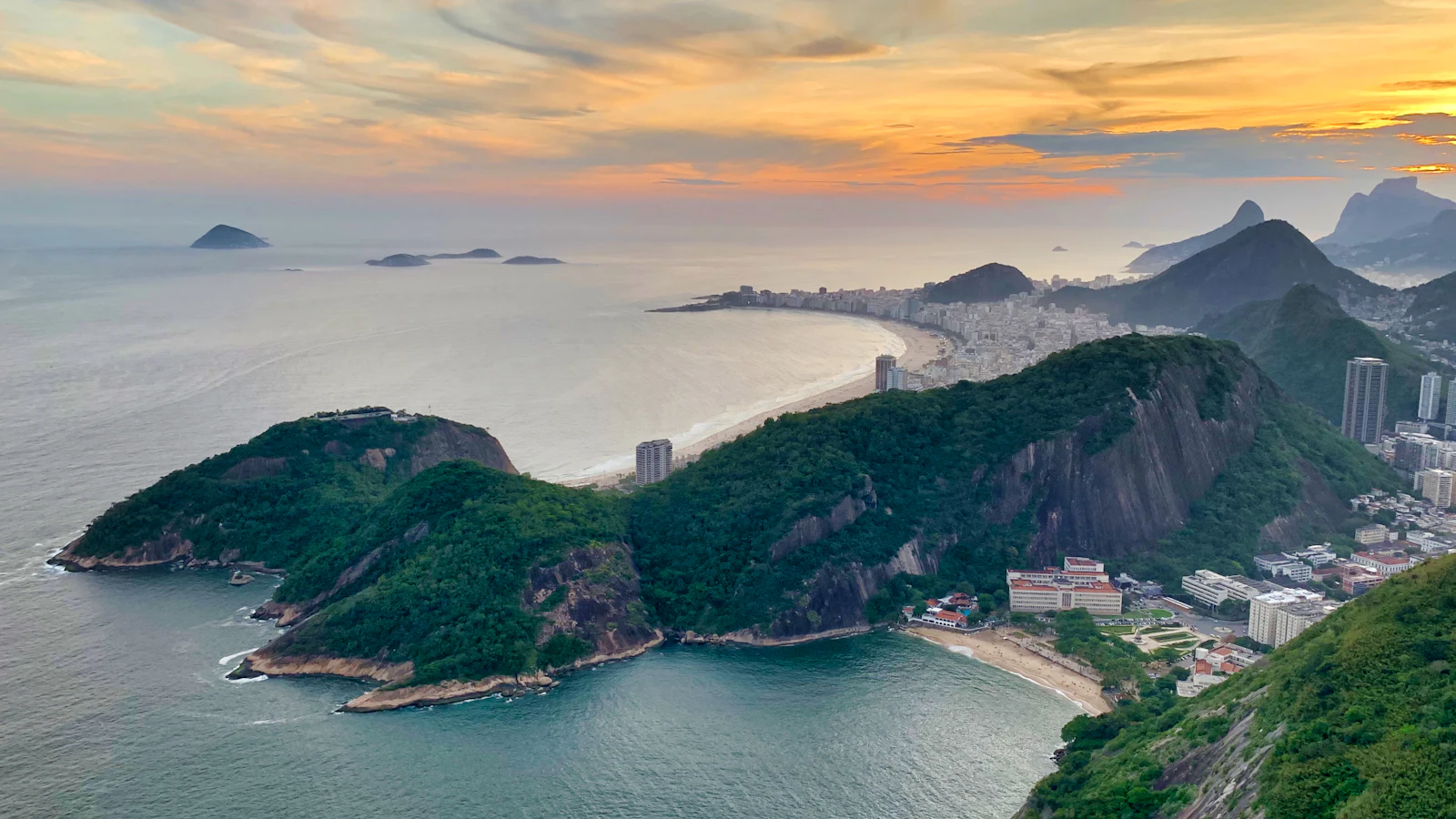
The Pão de Açúcar (Sugarloaf) cable car is the other essential. It climbs first to Morro da Urca (about 220 m) and then to the summit at 396 m, where an open 360-degree platform takes in the ocean, the bay and the city. Wind can be strong at the top, so bring a stable support. From Corcovado, beside the Christ the Redeemer statue at about 700 m, you look down the spine of the Zona Sul toward the coast; the platform is busy, so a faster shutter helps freeze the crowd. For a forest-framed angle, Pedra Bonita in Tijuca National Park (a short hike to the hang-glider ramp) opens onto the São Conrado coast and the Atlantic forest. Our roundup of the best viewpoints in Rio compares them in more detail, and the Sugarloaf photography guide covers that climb on its own.
- Shoot Mirante Dona Marta at first light for the classic Sugarloaf-over-the-bay frame with the fewest crowds.
- On Sugarloaf, arrive early or stay for golden hour, and bring a compact tripod for the windy summit.
- At Corcovado, use a faster shutter to clear moving tourists from the frame.
- Check the forecast — the cable car and clear views both depend on calm, low-haze weather.
Drone rules in Rio: strict and enforced
Drones in Brazil are regulated by the civil aviation agency ANAC, with airspace authorisation handled by DECEA. Any drone over 250 g must be registered with ANAC, and each flight in controlled airspace needs clearance through DECEA's SARPAS system. The rules are based on where you fly, not just how high or how light the drone is — a sub-250 g drone does not make the city centre fair game.
Wide no-fly restrictions cover airports and populated areas. Santos Dumont (SDU) sits right on the bayfront in the city centre and Galeão (GIG) is in the north, so much of central Rio and the tourist coastline falls under airport exclusion zones. Flying over crowded spots such as Copacabana or Ipanema without authorisation is illegal and can bring heavy fines and confiscation. National parks, including Tijuca, generally prohibit drones outright. If you are not certain a flight is cleared, do not fly.
Getting a genuine permit — ANAC registration plus DECEA authorisation, with insurance — is possible but slow, which is why most visiting photographers skip drones in the city and use a legal aerial alternative instead.
Helicopter tours: the legal way to shoot from the air
The straightforward legal route to true aerial shots is a helicopter tour. Licensed operators such as Helisight fly set routes from heliports at Morro da Urca and the Lagoa, circling Christ the Redeemer, Sugarloaf and the beaches. A short tour of roughly 20 minutes runs from around US$150 per person, with longer routes over the Tijuca forest and Zona Sul costing more; prices change, so confirm with the operator when you book.
Bring a light camera with a wide-to-standard zoom, since space and window size are limited and long lenses are hard to steady. Shoot through the open door or window rather than the glass where allowed, use a fast shutter (around 1/1000 s) to beat the vibration, and keep straps secured. Booking an early-morning or late-afternoon slot gives you softer light and longer shadows across the city.
Capturing the coastline: composition and settings
From any high point the coastline is your strongest compositional line, sweeping from Leme and Copacabana round to Ipanema and Leblon. A wide-angle lens takes in beach, city and mountains together, while a short telephoto compresses the peaks and high-rises into a denser, more graphic skyline. Morning light favours the east-facing beaches; late afternoon warms the western hills and the lagoon.
A polariser cuts haze and glare off the water and deepens the sky, which matters in Rio's humid, high-contrast light. A neutral-density filter lets you drag the shutter to smooth the sea against the sharp city. Bracket your exposures when the sky is much brighter than the land, and be ready to adjust fast as cloud shadows race across the bay. For the warmest window of all, plan around our golden hour viewpoints guide.
Frequently Asked Questions
Can I fly a drone over Copacabana or the city centre?
No — not without authorisation. Central Rio and the main beaches fall under airport exclusion zones and populated-area restrictions, and flying there without ANAC registration and DECEA clearance is illegal, risking fines and confiscation. When in doubt, don't fly.
What is the best viewpoint for the whole skyline?
The Mirante Dona Marta gives the classic frame of Sugarloaf and the bay with the Zona Sul below, and it is easy to reach. Sugarloaf's summit and Corcovado add height and a 360-degree or down-the-coast angle respectively.
How much is a helicopter tour over Rio?
A short tour of around 20 minutes starts near US$150 per person, with longer routes costing more. Prices vary by operator and season, so confirm when you book, and choose early morning or late afternoon for the best light.